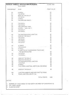
I have been working on how to get an accurate digital copy of a large format map into a single file. I bought a wand scanner two weeks back which did not work. The concept was good. Literally waving the tool across the paper on a flat table to get the best coverage. The package was battered and seemed like a secondhand item, which Amazon assured could not be the case. Amazon are taking it back and refunding me. But I still want to get the job done. Reading more about it, I have tools already for the job. I paid for an all singing all dancing photo editor with my new computer. If you treat scanned map segments from a flatbed scanner as photos, and tell the editor that you want a panorama made out of them. Voila a complete map in a single copy. This was a small map joined from two neat halves. The test will be a full topographic map with maybe up to six pieces. The editor also lets me draw on the map so I can show the order of checkpoints taken. The actual route in this case was to use the road network as much as possible then vere off when needed.
 |
| with route added |
I did this rogaine with James 30 yar ago, at age nine. That means I have a few years yet to get my legs going again before Asher might want a try at this stuff. We got 2nd place in a family category and walked about 10kms to get our 380 points. I walked about 5kms the other day but that was on a pavement.


No comments:
Post a Comment